Hike to Mizpah Spring Hut and Mount Pierce
The following is an excerpt from AMC’s Best Day Hikes in the White Mountains, 3rd edition, by Robert Buchsbaum.

MIZPAH SPRING HUT AND MOUNT PIERCE
LOCATION
Carroll, NH, to Hart’s Location, NH
RATING
Strenuous
DISTANCE
6.6 miles
ELEVATION GAIN
2,450 feet
ESTIMATED TIME
5.0–6.0 hours
MAPS
AMC White Mountain National Forest Map & Guide, G8
AMC White Mountain Guide, 29th ed. Map 1 Presidential Range, G8
USGS Topo: Crawford Notch to Stairs Mountain, NH
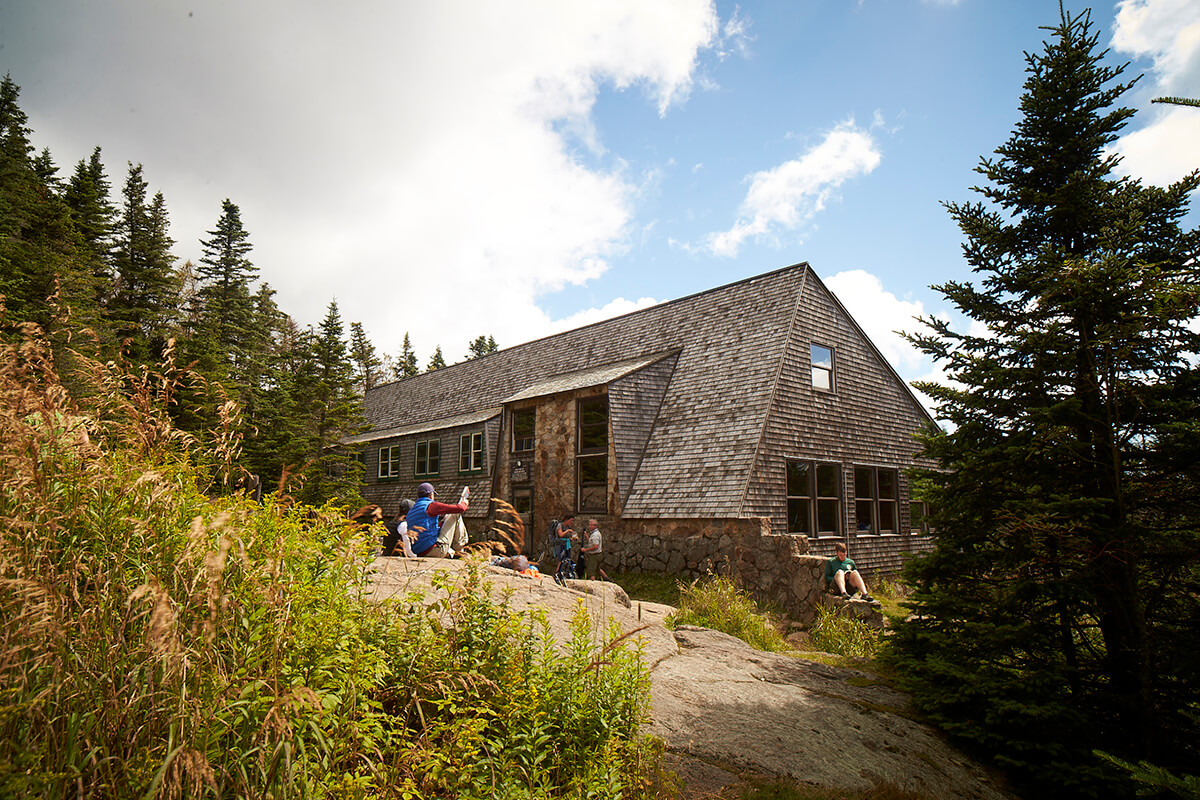
Mizpah Spring Hut, located in a clearing in the boreal forest at an elevation of 3,800 feet, is an excellent place to see mountain birds. Continue on to 4,312-foot Mount Pierce for terrific mountain views and a taste of alpine habitat.
CAUTION
This section of Crawford Path and the hike over the summit of Mount Eisenhower is mostly above treeline and therefore very exposed to the weather. It should not be attempted in stormy, icy, or very windy conditions.
DIRECTIONS
The trailhead for Crawford Path is near AMC’s Highland Center at the head of Crawford Notch. From the Jackson–North Conway area, follow US 302 west at Glen where it splits from NH 16. US 302 passes through Bartlett and then heads north through Crawford Notch. At the top of the notch, roughly 20.0 miles from the junction of NH 16 and US 302, the road goes through the narrow pass between two cliffs. If you are not staying at AMC’s Highland Center (parking for registered guests only), park in the hiker lot on Mount Clinton Road. This is a short (about 0.2 mile) distance off US 302, just beyond the Highland Center.From Franconia Notch and Twin Mountain, the hiker parking lot on Mount Clinton Road is about 8.0 miles south of the junction of US 3 and US 302 in Twin Moun-tain. GPS coordinates: 44° 13.41ʹ N, 71° 24.69ʹ W.
TRAIL DESCRIPTION
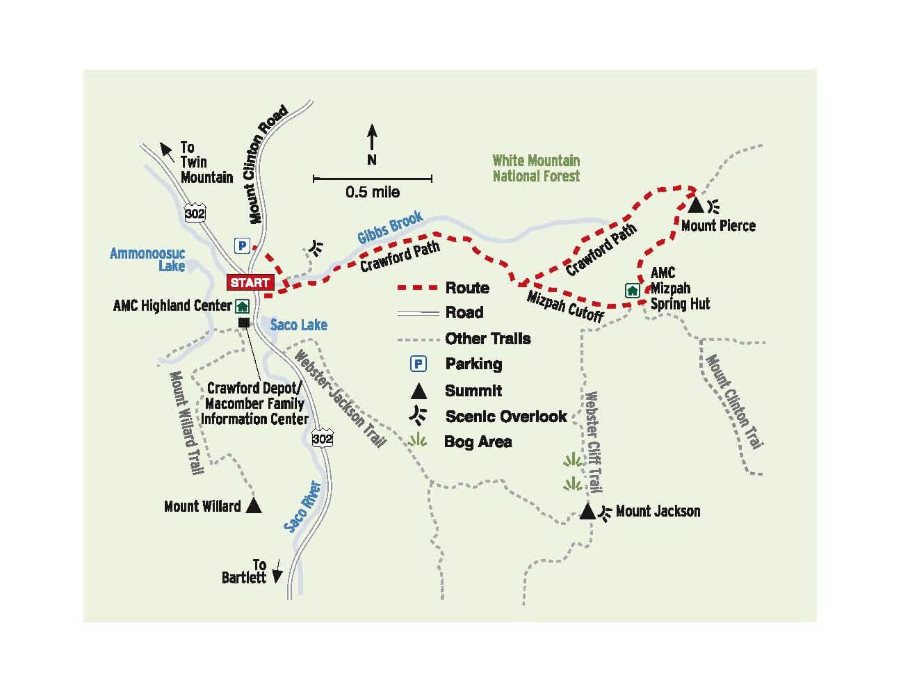
Much of this hike is on the historical Crawford Path (see page 202). You begin on Crawford Connector, which crosses Mount Clinton Road and links the parking area to Crawford Path. Just before the connector crosses Gibbs Brook, the Crawford Cliff spur trail diverges to the left.
This follows the north bank of the brook for a short distance to a pool, and then ascends steeply and roughly to Crawford Cliff, from where there is a fine view of the notch and the Willey Range. The distance to the overlook is 0.4 mile. It is worth a stop if you have the time.
Crawford Connector crosses a bridge over Gibbs Brook and ends at Crawford Path (which comes up directly from US 302 opposite the Highland Center) at 0.4 mile. Turn left and start ascending Crawford Path along the south bank of Gibbs Brook. The trail is nicely graded, varying between slight uphills and more-steep gradients. At 0.6 mile, a short spur path leads left to Gibbs Falls, a popular destination for guests from the old Crawford House Hotel. Men would hike in coat and tie, and women in hoop skirts. After passing the falls, you soon enter the Gibbs Brook Scenic Area. Take note of the old-growth red spruce and some very large yellow birch. Understory plants include hobblebush, clintonia (bluebead lily), mountain wood sorrel, and a variety of mosses.
The trail eventually turns away from the brook at about 1.2 miles. At 1.9 miles, the Mizpah Cutoff comes in from the right. Crawford Path continues straight for the summit of Mount Pierce, but we will save that for the descent. For Mizpah Spring Hut, take Mizpah Cutoff. This steadily ascends about 300 feet, eventually leveling out and passing across boggy sections on logs. The Cutoff joins Webster Cliff Trail 0.1 mile from the hut.

Completed in 1964, Mizpah Spring Hut was the last of the backcountry AMC huts to be constructed. It made a much more manageable overnight stop for people hiking between Zealand Falls Hut and Lakes of the Clouds Hut near Mount Washington. Several tent platforms are near the hut. While at the hut, you can use the restrooms, get a snack or a cup of cocoa, eat your lunch, and chat with staff and volunteers. In June the chorus of bird song emanating from the woods around the huts is wonderful. It includes Swainson’s thrushes, winter wrens, white-throated sparrows, dark-eyed juncos, and a variety of warblers.

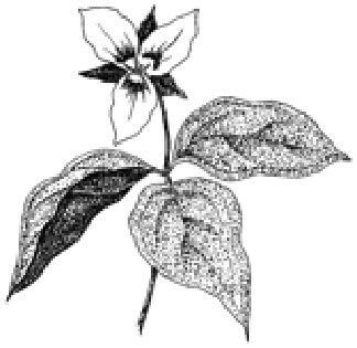
For the summit of Mount Pierce, continue ascending on Webster Cliff Trail. The trail ascends steeply from the hut, assisted at several points by ladders. You pass one open ledge with excellent views south and west, then descend slightly into a col. As the vegetation becomes scrubbier, listen for the song of the Bicknell’s thrush, an uncommon species whose existence high up in these mountains is threatened by warming climate. This streaked brown bird sounds a bit like a harpsichord playing a series of notes all at one pitch. There are also a few nice patches of painted trillium (illustrated here) off the trail.

Webster Cliff Trail reaches the open summit of Mount Pierce, 0.8 mile and a 500-foot elevation gain from the hut (total of 3.4 miles from the trailhead). Formerly known as Mount Clinton, after De Witt Clinton, the governor of New York who built the Erie Canal, Mount Pierce was renamed to honor Franklin Pierce, the only president to have hailed from New Hampshire. Enjoy wonderful, near-360 degree alpine views, including the Southern Presidential Range up to Mount Washington toward the northeast and many peaks in other directions. The summit also provides a sample of the White Mountains’ unique alpine (above timberline) habitat. Note the uniquely adapted alpine cushion plants diapensia and alpine azalea, which bloom in early June, and low shrubs such as bog bilberry, Labrador tea, and black crowberry. (See page 260 for more on the alpine zone.) From the summit of Mount Pierce, continue 0.1 mile on Webster Cliff Trail to its terminus at Crawford Path. Turn left and descend on Crawford Path. This section of the path is a bit eroded and can be wet after heavy rains, but overall the footing is good. Crawford Path reaches Mizpah Cutoff at 4.7 miles (1.2 miles from Webster Cliff Trail). Here you retrace your steps down Crawford Path to Crawford Cutoff (6.2 miles) and the trailhead (6.6 miles).
OTHER ACTIVITIES
If you have two cars, nice weather, and extra time, you could combine this hike with the Mount Eisenhower hike (Trip 41). Leave the second car at Edmands Path trailhead, which is along Mount Clinton Road 2.0 miles east of Crawford Path trailhead. At the summit of Mount Pierce, instead of descending on Craw-ford Path, you would continue along Crawford Path to the northeast for 1.2 miles until you reach Mount Eisenhower loop. After summiting Mount Eisenhower (0.3 mile), continue on the Loop for another 0.3 mile to Edmands Path, and descend on it for 3.0 miles to Mount Clinton Road.
DID YOU KNOW?
Crawford Path, first built in 1819, is considered the oldest continuously maintained hiking path in the Northeast.
MORE INFORMATION
Crawford Path is in the White Mountain National Forest; www.fs.usda.gov/whitemountain. There is a user fee ($3 per day) for parking in the Mount Clinton Road lot.
If you enjoyed this excerpt, you may consider purchasing a copy.


