A Breath of Fresh Air: 8 Hikes on the Appalachian Trail in Massachusetts

In early August 2020, amid the necessary isolation and semi-isolation brought on by COVID-19, I was feeling anxious and blue. I needed a change of scenery and a project. I set my mind to hike the Appalachian Trail in Massachusetts from Jug End in South Egremont, Mass., to the Vermont state line in a series of day hikes. Section-hiking the route alone brought many physical and mental challenges, but also meditative moments, solace, and incredible joy and peace on the trail. Here are my reflections from eight of the more memorable sections I hiked with my dog, Oliver, and now recommend.
Note: The mileages indicated below are the author’s best approximation. For specific directions, reference points, and mileage, please consult the Appalachian Trail Guide for Massachusetts–Connecticut, published by the Appalachian Trail Conservancy. Also note that because of the weather and the work of the A.T. maintenance crews, some of the landscapes described may have changed from a year ago.
Homes Road to Route 23 | Sheffield and Great Barrington, Mass.
After parking along Homes Road in Sheffield at the intersection of the A.T. (map to park), a steep climb to the ridge of East Mountain leads us 1.4 miles to a flat boulder. In full sun, it is a balcony with a spectacular view of the Taconic Range across the Housatonic Valley. The A.T. runs in the trees between a vertical ledge and a ravine, with that lovely view on the Taconic Range through the branches.
From the ridge the trail meanders through the woods towards the Ice Gulch, 2.2 miles from the boulder. After a steep drop over boulders, we walk on in a dauntingly beautiful landscape of massive glacial boulders and steep escarpments where vegetation grows out of crevices.
Difficulty: Moderate to Hard
Distance: 5.4 miles one way

Route 23 to Tyringham Main Rd. | Great Barrington and Tyringham, Mass.
I’m roughly half-way through today’s 12.3-mile hike, which started at Route 23 in Great Barrington. (map to park) Several days earlier a storm had uprooted many trees. A dim, grey light filters through the tree canopy. I stop. A root ball towers over me; the dark vision of the tree’s underworld is fascinating. A giant lies motionless across the trail, a formidable obstacle obstructing the view to the next white blaze. I take a deep breath, climb on the trunk, above and below branches. After a few unending minutes, I spot the next white blaze indicating I’m still on the A.T.
The trail ascends to another large, uprooted tree blocking the path and my view of the next blaze. The sense of wilderness and solitude grows. Determined and pushing away thoughts of spiders and other critters, I crawl through the branches, back and forth, scanning the surroundings for the next white blaze. Then I move on.
Uprooted trees are a challenging interruption in this lifesaving line that are the white blazes. A mature tree stretching on the ground across a path can throw one’s sense of orientation off. Even 20 feet off the trail, without markers, the path disappears, the forest looks identical in all directions. Tackling the width of the tree by climbing over and under the trunk and the branches, close to where the trail stopped, is safer than bushwhacking around the tree—and easier on the forest.
Difficulty: Moderate to Hard
Distance: 12.3 miles one way
Goose Pond Road Rd. to US20 | Tyringham and Becket, Mass.
The forest trees seem to grow roots directly in Upper Goose Pond. A light breeze blows ripples on the surface. Fishermen, idle in their boats and basking in the late morning sun, wait for fish to bite.
Dark clouds roll in. Then, thunder, lightning, and a deluge! Briefly I worry, worry about branches falling and lightning traveling in the ground along roots… The trail is soggy, the mud squishes under my soles, the rocks and roots are slippery, the dog and I are drenched. The pink and black spots on Oliver’s skin show through his wet white coat; his short paws and belly are black with mud. Ears pulled back, Oliver trots along, one paw in front of the other. I adore him! Soaked to the bone, we look like wet rats! Wood frogs, their skin glistening from the rain, and a slimy red eft, cross the trail. I am now thoroughly enjoying the warm rain!
Difficulty: Easy
Distance: 4.5 miles one way
County Road to US20 | Becket, Lenoxdale, and Pittsfield, Mass.
The path, a cushion of pine needles, rolls in a dark forest of hemlocks. Over a knoll, 1.5 miles from the county road where I started (map to park), a giant hemlock shoots toward the sky, its trunk very wide, very powerful. On it, a newly painted blaze is illuminated by a ray of sun. The glossy white paint is glowing and vibrating; the blaze is incandescent. It feels like a beacon in the dark forest sending a message of hope from above. A few minutes earlier or later, the blaze would have been in the shade. Grateful, I lean against the hemlock’s trunk, a trunk far too wide to wrap my arms around it; I feel the ruggedness of its bark and its silent and protective strength.
Another mile along the trail, more serenity awaits on the shore of Finerty Pond. In the golden light of the morning sun, the bright blue of the calm water and cloudless sky are pure beauty. I feel in the right place.
Difficulty: Moderate
Distance: 5.4 miles one way
County Road, Stamford, Vt., to North Adams, Mass.
“Welcome to Massachusetts,” the sign reads at the state line. “Welcome to the Vermont Long Trail,” reads a sign facing the other direction. “A footpath in the wilderness.” I’ve hiked 3.1 miles from County Rd. in Stamford, Vt. (map to park), to the state line in Massachusetts’ Clarksburg State Forest. After gently sloping toward North Adams, the trail becomes a nasty slope of angular rock fragments all jumbled together and sticking upward like broken shards, roughly 1.5 miles from the state line. Oliver and I watch our steps very closely.
After another 1.4 miles from the boulder field, the path flattens out along Sherman Brook. Tired, relaxed, not paying attention, I pick up the pace. My left foot catches a root. Caught off-guard, I fall on my forearms and my face. My nose twists. It cuts the wind out of me. I sit up, my nose bleeding profusely. From my daypack I retrieve a terry towel with which I pinch my nose to stop the bleeding. Oliver stands by my side, gently looking at me. Having no symptoms but the nosebleed, I get up and lean against a tree to regroup. Still pinching my nose with the towel, I start walking. Eventually the nosebleed stops and, exhausted, I hike the remaining 2.1 miles and finally reach my car on Pattison Road. Hiking Mount Greylock will have to wait.
Difficulty: Hard
Distance: 8.1 miles one way
Pattison Road to Mount Greylock summit | North Adams, Mass.
From Pattison Road in North Adams (map to park), the trail ascends 3.1 miles over steep rock steps to the top of Mount Williams (2,951 ft.). I sit on a rock surrounded by birches, red maples, and deciduous trees displaying their vibrant autumn colors. Yellow, light green, and red leaves slowly spiral down. There, the A.T. makes a hairpin turn which is easy to miss. Going south, the blazes are far apart and difficult to see, the white having faded to grey. Covered by fallen leaves, the trail’s edges sometimes blend with the understory. It is difficult. It starts raining. The sound of raindrops on the canopy is rhythmic and soothing. As the trail ascends to the summit of Mount Greylock (3,491 ft.) at Bascom Lodge, 2.3 miles beyond Williams’ summit, a woman holding a leashed Great Dane calls out to me: “He is very friendly!” The dog looks at me with droopy eyes and shakes the drool off his lips onto my shoulder, totally uninterested in me. At Bascom Lodge, I meet a driver who takes me back to my car on Pattison Road and who will drive me back to the summit the next morning for my final hike down to Cheshire.
Difficulty: Hard
Distance: 5.4 miles one way

Bascom Lodge to Cheshire, Mass.
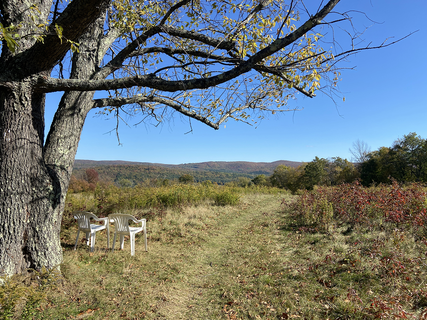
I start at Bascom Lodge. (map to park) A mile beyond Greylock’s summit, balsam firs grow in the understory and along the trail, undisturbed, with beautiful green and waxy needles. Their sweet fragrance wafts through the air for an eternity, reminiscent of Christmas. Two miles later before descending for another 3.5 miles toward a forest of hemlocks, the trail is a treacherous amalgam of slippery rocks, roots, leaves, and acorns rolling under my soles. Then, in a clearing full of sun, a dead tree arches over the trail like an oversized sculpture. Its trunk is split above the base and the branches form a dome of fractured wood. Back in the valley 0.8 mile past the hemlock forest, under a lone tree in an open field, two white garden chairs face the Cheshire Cobbles on a hill ablaze with fall colors. The mid-afternoon sun is warm, I sit down to rest and admire the surrounding beauty. This is trail magic at work!
With a mix of pride, joy, and nostalgia, I reach my car in Cheshire. (map to park)
Difficulty: Hard
Distance: 8.3 miles one way


