8 Great Hikes in Massachusetts

Excerpted and adapted from the newly updated Massachusetts Trail Guide and Map, 11th ed., out now from AMC Books.
From the summits of the Berkshires to the sands of Cape Cod National Seashore, Massachusetts is home to a multitude of natural areas and recreational opportunities. Massachusetts has a rich tradition in land conservation and as a result contains an extensive number of trails, far more than the size of the state might imply. Whether you’re looking for an easy stroll around a pond or wildlife sanctuary or for a longer hiking expedition, you’ll find a choice of trails suited to all abilities. Here are eight Bay State routes to try this summer or fall.
1. DAUGHTERS OF THE AMERICAN REVOLUTION STATE FOREST: HIGHLAND LAKE | Universal Access Nature Trail | Goshen
This short trail runs along the south shore of Upper Highland Lake. Starting from the south boat launch near the grassy earthen dam and beach, it leads to the parking lot on the east bay just south of the campground and the Long Trail trailhead. An information kiosk by the south boat launch offers maps as well as additional information in Braille. Universal Access facilities include a fishing area and a gazebo on a promontory on the shore. The trail passes through mixed hardwood-hemlock forest and offers several rest benches and many relaxing views of the lake.
Difficulty: Easy
Distance: 0.8-mile round trip
Info: Daughters of the American Revolution State Forest; Massachusetts Trail Guide, 11th Edition, p. 162
2. BLUE HILLS RESERVATION: HOUGHTON’S POND | Yellow Loop | Milton
This easy 1-mile trail is a popular walk for families with small children. From I-93, take Exit 3 north. Turn right onto Hillside Street and then right into the parking lot in 0.3 mile. The trailhead is at the main parking lot for the Houghton’s Pond swimming area. Visitors can enjoy supervised swimming at the pond in summer.
The trail proceeds to the left (east) past the beach, bearing right just after the bathhouse. It joins a dirt road for a short distance around the eastern tip of the pond and then turns right off the road. The trail continues along the southern shores of the pond (Great Blue Hill is visible across the water), crosses the pond’s outlet at the western end, and heads north past a field. It then travels through a small swamp and bears left (east) up a hill past a pavilion to the starting point.
Difficulty: Easy
Distance: 1-mile loop
Info: Blue Hills Reservation; Massachusetts Trail Guide, 11th Edition, p. 328

3. WELLFLEET BAY WILDLIFE SANCTUARY | Goose Pond–Try Island Trail | Wellfleet
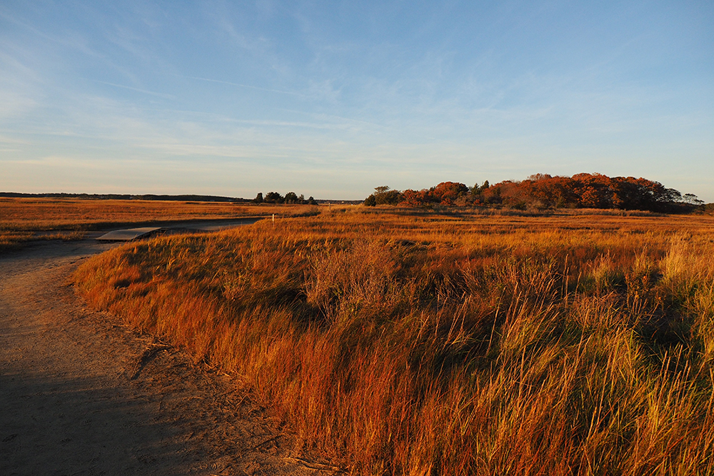
This popular walk offers outstanding wildlife viewing opportunities. The sanctuary’s marked access road is on the west side of MA 6 at the Wellfleet–Eastham town line. From the trailhead at the nature center, bear left, following signs for Goose Pond–Try Island Trail. The route passes Silver Spring Pond and soon leads to a bird blind and short boardwalk at nearby Goose Pond. After passing an observation deck, the route reaches a junction at the edge of the marsh at post 33.
Bear right and follow Try Island Trail through a small hummock of mature forest to an overlook on the right, then descend to the boardwalk. The boardwalk leads to a picturesque area where Hatches Creek meets the bay. Retrace your steps along the boardwalk and follow the path along the edge of the marsh back to post 33. Bear right to continue the Goose Pond circuit. Goose Pond Trail runs along the marsh edge and then bears left, passing through an open heathland before completing the loop near the pond boardwalk. Turn right to return to the nature center.
Difficulty: Easy
Distance: 1.6-mile round trip
Info: Mass Audubon Wellfleet Bay; Massachusetts Trail Guide, 11th Edition, p. 422
4. WHITNEY AND THAYER WOODS | Blue Loop and Yellow Loop | Cohasset
Enter the reservation from MA 3A opposite Sohier Street in Cohasset, 2.0 miles south of the junction of MA 228 and 3A. From the entrance, begin Blue Loop on Howe’s Road. At 0.3 mile, turn right on Boulder Lane, which goes northwest over rolling terrain past Bigelow Boulder, ending at the intersection with Whitney Road and Yellow Loop.
From the western junction with Blue Loop/Boulder Lane, Yellow Loop leads northwest on Whitney Road to join Red Loop at Ayer’s Lane. Turn left and follow Ayer’s Lane south 0.4 mile to the intersection with Milliken Memorial Path. Turn left, leaving Red Loop, to follow Yellow Loop along Milliken Memorial Path, which is known for its rhododendrons and azaleas. At a junction near Brass Kettle Brook close to the boundary with Wompatuck State Park, Yellow Loop turns left on the southern portion of Howe’s Road. Follow Howe’s Road northeast to the eastern junction with Blue Loop at Whitney Road. Continue straight on Howe’s Road/Blue Loop to return to the MA 3A trailhead.
Difficulty: Easy
Distance: 3.9-mile loop
Info: Whitney and Thayer Woods; Massachusetts Trail Guide, 11th Edition, p. 336
5. WILLARD BROOK | Brook Trail and Friends Trail | Ashby
To reach Damon Pond from the junction of MA 119 and MA 124 in West Townsend, go 3.1 miles west on MA 119 and turn left onto Hosmer Road. From the covered bridge near Damon Pond’s outlet, Brook Trail leads along the south bank of Willard Brook through hemlock forests heading downstream. Brook Trail travels over gently rolling terrain and at 1.2 miles reaches the Trap Falls Brook area and a gravel forest road. Turn right (south) on the road and bear right at the next two intersections. After passing a small pond, bear right on orange-blazed Friend’s Trail and follow it generally west past two connector paths that link to Brook Trail. Pass the junction with a path on the left that leads in about 0.2 mile to Fort Hill Road, and complete the loop at Hosmer Road, just east of Damon Pond.
Difficulty: Moderate
Distance: 3-mile loop
Info: Willard Brook State Forest; Massachusetts Trail Guide, 11th Edition, p. 277

6. CRANE BEACH | Green and Red Trails | Ipswich
From MA 128, take Exit 20A and follow MA 1A north for 8 miles to Ipswich. Turn right onto MA 133 East, drive 1.5 miles, and turn left onto Northgate Road. After 0.5 mile, turn right onto Argilla Road, and drive 2.5 miles to the refuge entrance at the end of the road. The Ipswich Essex Explorer bus provides seasonal service to Crane Beach from MBTA’s Ipswich Station on the Newburyport commuter rail line.
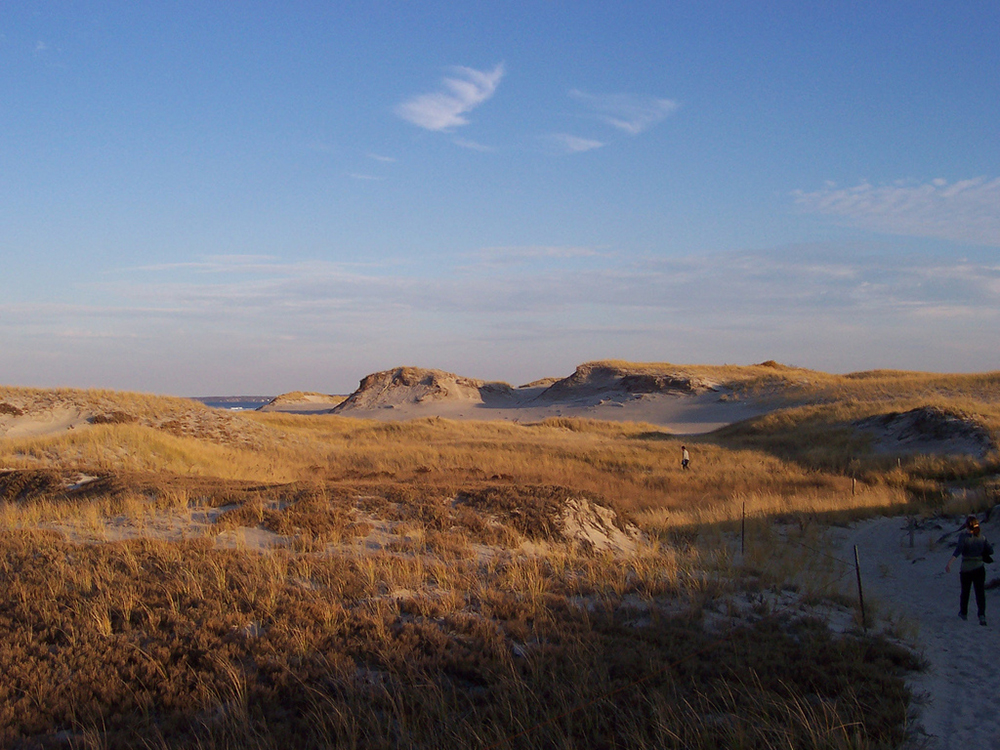
From the east side of the parking lot, walk a short path to Green Trail. Bear left and continue through pitch pine–scrub oak woods. At the junction with Red Trail at marker 5, continue left on Red Trail, which crosses over a chain of rolling dunes with several fine viewpoints. At marker 21 on Red Trail, a side path branches to the southern tip of the peninsula and Castle Neck River. To complete the hike, follow Red Trail back to Green Trail at marker 25 and then walk along the base of Wigwam Hill on Green Trail to the parking area.
Difficulty: Moderate
Distance: 3.6-mile loop
Info: Crane Beach; Massachusetts Trail Guide, 11th Edition, p. 312
7. MOUNT HOLYOKE | New England Trail | Mount Holyoke Range State Park, Hadley
The western portion of the Mount Holyoke Range contains some of the finest views along the New England Trail (NET), with a succession of perspectives of the Connecticut River valley and pastoral farm fields. This area is forested, wild, and quite unspoiled.
From the intersection of MA 47 and Old Mountain Rd., follow Old Mountain Rd. 0.5 mile to the trailhead on the left. The NET bears right and leads uphill to a power line, passing a private cabin (no trespassing). A vernal pool is below on the right. The trail turns left at the junction with red-blazed Dry Brook Trail (marker 101) and continues uphill through hem-locks, passing under power lines and reaching an open ledge with views to the south and west. It heads through oak-hemlock woods and then bears left along the western side of the ridge, with views to the west and north.
After descending into a hemlock dell, the trail leads uphill past another vernal pool, reaching open ledges with pleasant scenery to the south. The route runs parallel to a high traprock cliff on the right, descends a rocky talus slope, and climbs to more open ledges.
At marker 121 at 1.1 miles, the NET briefly merges with green-blazed Hang Glider Trail, so named because it leads west to a popular hang glider launching area at a lookout. The combined trails climb higher on the rising ridge, heading east, and then north. The NET crosses a rock wall and bears left, descending on an old road northward. At 1.8 miles it intersects blue-blazed Halfway House Trail, which descends left to the Halfway House parking lot at marker 102. The NET continues another 0.1 mile to the historical Mount Holyoke Summit House at 1.9 miles.
The Summit House affords superb views across the Pioneer Valley. Water and restrooms are available when the house is open to the public from May to October. Backtrack to return to the trailhead.
Difficulty: Moderate
Distance: 3.8 miles round trip
Info: Mount Holyoke Range State Park; Massachusetts Trail Guide, 11th Edition, p. 123
8. MONUMENT MOUNTAIN | Hickey Trail, Peeskawso Peak Trail, and Mohican Monument Trail | Stockbridge
To reach the reservation, follow US 7 north 3 miles from the junction with MA 23 in Great Barrington or south 3.0 miles from the junction with MA 102 in Stockbridge. From the entrance, Hickey Trail passes north through woods before beginning a moderate climb. The route crosses a bridge over a brook and then passes a cave behind a waterfall. After climbing a gully, Hickey Trail turns left, crosses another bridge, and scrambles over a boulder field to reach Inscription Rock.
Peeskawso Peak Trail, marked with red blazes, begins at Inscription Rock and leads steeply up stone steps to the quartzite outcroppings that mark the true summit of Monument Mountain (1,623 feet). The route descends into a small saddle between the two peaks before climbing to the ragged, sheer cliffs of Peeskawso Peak. A short side loop leads to an overlook with an excellent view of the Devil’s Pulpit, a unique freestanding rock column. Peeskawso Peak Trail descends, steeply at first, below the Devil’s Pulpit vista and then continues west along the ridge down the slope to join blue-blazed Mohican Monument Trail 0.75 mile from the parking area.
Difficulty: Moderate
Distance: 2.4-mile round trip
Info: Monument Mountain; Massachusetts Trail Guide, 11th Edition, p. 83


